The Nottinghamshire Historic Environment Records office has accessioned the Miner2Major Veiled Landscape Project Light Detection and Ranging (LiDAR) survey data into their digital mapping collection. The survey has produced the highest-resolution LiDAR models of the Sherwood Forest and its environs available to date (16cm), and now anyone can view and explore this data online using the slider tool on the map window.
LiDAR can be a useful tool in identifying and understanding archaeological features, even ones obscured by tree canopy and thick undergrowth that can be hard to spot in the field. Airborne LiDAR works by firing invisible laser beams from an aircraft to the ground and measuring the time it takes for the beam to reach the aircraft again. This measurement indicates the distance the object is from the receiver, and by collecting many hundreds of thousands of these laser points, a highly detailed topographic map can be produced. The more laser beams are fired, the more detailed the map, and the LiDAR survey of the Miner2Major project area is the highest-resolution survey that has been flown to date.
Two single-hillshade digital terrain models (DTM) are available to explore in the Nottinghamshire HER online mapping portal. The Sherwood Lidar (Hillshade NW Sun) is a view of the landscape with the natural features illuminated as though the sun is shining from the NW and the Sherwood Lidar (Hillshade NE Sun) is the view as if the sun was shining from the NE.
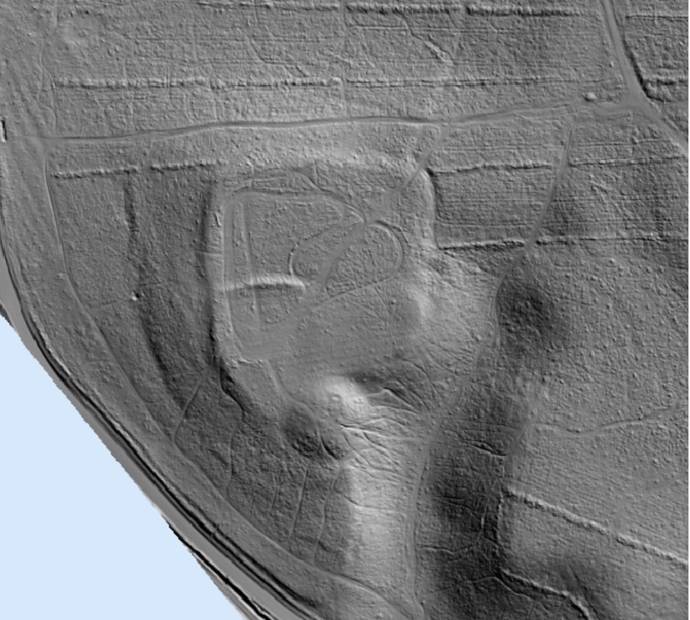
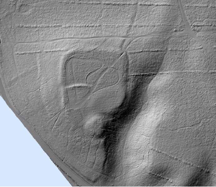
There are many ways the same LiDAR data can be processed and no single method can show everything, so there is a danger of assuming that an absence of archaeological features in one LiDAR model reflects an absence of archaeological features in reality. LiDAR is just one tool that can help us understand the landscape, and it should be used in conjunction with other datasets or methods of investigation.
The accessioning of this LiDAR data into the HER was made possible by the generous support of the Miner2Major project, supported by the National Lottery Heritage Fund.
Further reading
Further information about The Veiled Landscape project can be found on the Miner2Major Website
The Miner2Major Veiled Landscape Project LiDAR data is also available to view on the (NLS) National Library of Scotland Website. The NLS has processed both a DTM and a digital surface model (DSM). A DSM is a view of the landscape that captures both the natural and built features of the environment (such as trees and buildings, for example), while a DTM is a view of the landscape with those features removed.
For more information on LiDAR and its applications:
Using LiDAR Layers for Research
The Environment Agency regularly conducts LiDAR surveys and the datasets are freely available online via the DEFRA Data Services Platform
Historic England has published a useful guide on using LiDAR in archaeological survey. More information can be found here at the Historic England Website