This article comes from a 2003 NCC Heritage Newsletter:

Have you ever wondered where the name Eakring comes from? What about the village of Spion Kop? It should come as no surprise that the origin of many English place-names is a complicated one.

Although the study of place-names is a development of modern scholarship, interest in the subject can be traced back as early as the 8th century in England when the Venerable Bede (673-735 AD) included Latin explanations of some of the place-names he mentions in his ‘Ecclesiastical History of the English People’, completed in 731 AD.

The study of place-names is based on a patient and careful collection of as many early spellings of a given name as possible. Even so, it would be wrong to simply regard the study of place-names as the sole preserve of linguists. Today, it owes much to the fields of social and economic history, historical geography and archaeology.

Place-names of Celtic, and even pre-Celtic origin (some of which still survive), were already in use before the coming of the Anglo-Saxons in the second half of the 5th century. By the time of the Norman Conquest in 1066, the vast majority of our old place-names, whether of cities, towns, villages, parishes or even farms, were in existence. Because many of our place- names are so old it is necessary to trace the forms back to the earliest possible date and thereby the earliest spelling if we are to fully understand their meaning. Unfortunately, this is not as easy as it sounds. During this period, our shores suffered a multitude of foreign invasions, and therefore today’s place-names derive from a variety of languages including pre-British, British, Latin, Old English, Old Norse and Norman French. The situation is further complicated by the fact that comparatively few spellings from pre-conquest times have survived, mainly because of the loss of early documents.

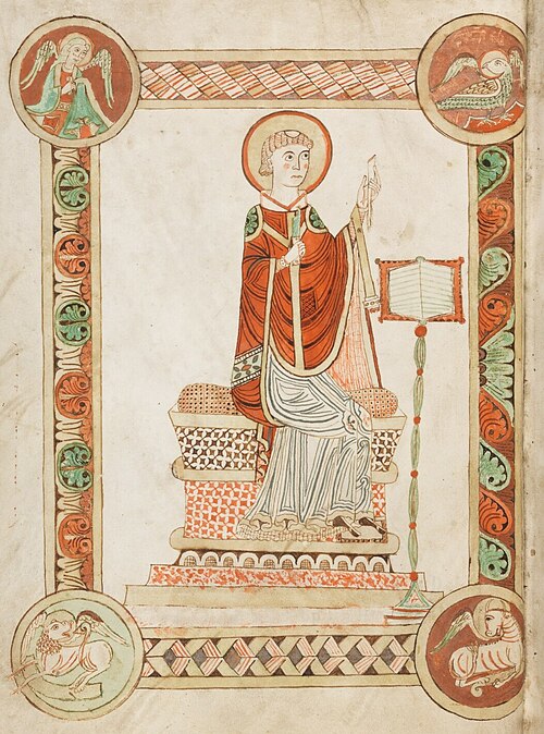
Above: Venerable Bede writing the Ecclesiastical History of the English People, from a 12th-century codex at Engelberg Abbey, Switzerland (by e.codices, Public Domain)

Place-names, whatever their origin, can be divided into two principal types; habitative and topographical. The first type denotes inhabited places such as farmsteads, enclosures or villages. These habitative place-names can usually be split into two parts. In names of this type, the second element usually describes the kind of habitation, while the first may be a descriptive word. For example, Higham (‘high homestead’), or Woodborough (‘stronghold by the wood’). In other forms, the first element may actually be a person’s name, such as Ragnall (‘Ragni’s hill’), or the name of a tribe or group of people, as is the case of Beckingham (‘the homestead of Becca’s people’).

The second type of place-names consisted originally of a description of some topographic feature, such as a hill, wood or stream. Examples include Blackburn (‘dark stream’) and Greenhill. More local examples included East and West Leake which are situated on the banks of a small stream that joins the River Soar at Kingston. In this case, both names derive from the old Norse word ‘loekr’. A further example is that of Eakring. The name here comes from a compound of Old Norse ‘eik’ (oak) and ‘hringr’ (ring or circle), and may have originally referred to a circle of oak trees.

Unlike the name Eakring, which as been with us for around a thousand years, Spion Kop (near Warsop) is a relatively recent settlement which takes its name from the 1900 battle of Spion Kop, which took place in South Africa during the Second Boer War (1899-1902). ‘Kop’ is an Afrikaans word meaning ‘look-out hill’ and is therefore c17th Dutch in origin.

It should come as no surprise that the name Eakring is Scandinavian in origin, as Notts was one of the earliest parts of England occupied by Viking invaders. Nottingham, along with Derby, Leicester, Stamford, and Lincoln, formed one of the Five Boroughs of the Danelaw, an area of England subject to Danish Law and recognised by King Alfred of Wessex who signed a treaty with Guthrum, leader of the Danes, in 886 AD. For those of you interested in discovering the Viking origins of some of Nottinghamshire’s place-names here are some of the most common Scandinavian elements used in English place-names.

Common modern forms

Meaning

Source

Bank, -bank, Barrow-, Bar-

Bank, ridge

Old Danish, banke

Berg-, -ber, -berry, -borough

Hill, mound, tumulus

Old Norse, berg

Beck-, -beck

Beck, stream

Old Norse, bekkr

Booth, -booth, -both

Booth, temporary shelter

Old Danish, bôth

Old Norse búðl

Breck, -breck, -brick

Slope, hill

Old Norse, brekka

-by

Farmstead, village

Old Norse, by

Carr, -carr, -car, -ker

Marsh, bog

Old Norse, kiarr

Dale, dal-, -dale

Dale, valley

Old Norse, dair

-ergh, -er

Shieling, hill-pasture

Old Norse, erg

Gate, -gate

Way, road, street

Old Norse, gata

Holme, -holme, -holm, -ham

Small island

Old Norse, holmr

-how, -howe, -hoe, -oe

Hill, mound, tumulus

Old Norse, haugr

Hulme, -hulme

Island, water meadow

Old Danish, hulm

Keld-, Kel-, -keld

Spring

Old Norse, kelda

Lound, lund, lunt, -land

Grove, copse, sacred grove

Old Norse, lundr

Stain-, stan-, sten-

Stone

Old Norse, stein

Thorpe

Secondary settlement or farm

Old Danish, þviet

Toft, -toft

Meadow, clearing

Old Danish, toft

Wath, -wath, -with, -worth

Ford

Old Norse, vað

What Is Heritage Crime?

Heritage crime can be any act that causes harm to an asset or its surroundings.

For example, damaging or undertaking unauthorised alterations, such as building upon or digging up, heritage assets are considered a heritage crime. Even things that might seem innocent like metal detecting without authorisation, making ruts in the soil of an asset using a bike, or putting in fencing without permission can be considered a heritage crime.

Other crimes that are not necessarily specified as a heritage crime can also affect sites and historic landscapes. This could be graffiti, fly-tipping, theft, criminal damage, or arson.

Scheduled assets are legally protected against crimes, which means anyone who causes damage to any assets could have enforcement taken against them and ultimately be prosecuted. In such cases The Local Authority, Historic England and the Police work together to establish the facts and take any required action.

Protected heritage assets that we have in Nottinghamshire include:

Other protected heritage assets, that aren’t present in Nottinghamshire, are World Heritage Sites, protected marine wrecks, and protected military remains of aircraft and vessels of historic interest.

You can check whether an asset is scheduled or listed by searching the Historic England database. Historic England maintains and updates all records of designated assets. Search the National Heritage List here.

You can also check the protected heritage assets specifically in Nottinghamshire via the ‘designations’ section of our search page.

Photograph of graffiti at King's Mill Viaduct

Above: Graffiti at King's Mill Viaduct, Mansfield

Why Does It Matter?

Heritage crimes not only threaten our valuable local assets, but they threaten to destroy both local and national understanding (current and future) as well as public enjoyment.

Alongside large areas like conservation areas and designated parks and gardens, there are a range of smaller assets can be listed or scheduled, such as bridges, war memorials, phone boxes, even garden urns. Heritage assets are all around us and some people may not realise how special the things around them are.

 A large number of our heritage assets in Nottinghamshire are in remote areas or lack the protection of physical security features, so we rely on everyone keeping an eye out and reporting any issues or signs of damage/alterations.

A study conducted by Newcastle University, Loughborough University and the Council for British Archaeology in 2011 suggested that over 70,000 listed buildings (18.7% of all listed buildings at the time) had been affected by crime in a single year. Within that, nearly half of those buildings (30,000) had been majorly affected by the crime committed.

The study also suggested that antisocial behaviour is one of the most common threats to our historical sites. In a year, 12.3% of all heritage assets were affected by antisocial behaviour.

You can read the full 2011 study here: Heritage Crime: the size of the problem

To learn more about heritage crime, how large scale the issue is, and why it matters, visit the Historic England website here.

Photograph of General Baptist Chapel, Kirkby Woodhouse, with no roof due to fire

Above: General Baptist Chapel, Kirkby Woodhouse, with no roof due to a fire/vandalism.

What To Do If You Spot A Heritage Crime?

If a crime is in progress, a suspect is nearby, violence has been threatened or is occurring, or there is danger to life – treat this an emergency and call the police through 999.

If you witness a heritage crime that is not an emergency and not currently occurring, or suspect one has been committed, report it to the police through 101 or anonymously through Crimestoppers through 0800 555 111.

There is currently a team of six police officers equipped with specialist skills to deal with heritage crime courtesy of training by Historic England. ‘Those interested in getting in touch with an officer can contact the heritage crime team via email at heritagecrime@notts.police.uk’. You can read more about the new heritage crime police team here.

If it is not an emergency and you are unsure or would like some guidance on reporting a heritage crime, you can contact our NCC heritage team who will be able to help you via our email at heritage@nottscc.gov.uk

This fascinating articles originates from our Winter 1998 Heritage Newsletter:

It was the builders, early in the eighteenth century who started the charming practice of placing semi-circular fanlights over their front doors. At first these were of wrought iron, lead, or wood; Robert Adam used wrought iron with delicate enrichments in copper or brass for splendid country houses. But soon he, and his brothers James and John, were all devising fanlights intended for mass production, so that it was not long before cast iron captured this market; some of the designs were very light and dreary.

Diagram of a Gothic Revival fanlight

Wood was used for the glazing bars of fanlights in the early eighteenth century, but by the 1740’s the call for elaborate shapes, difficult to make in timber, gave rise to the use of leaded metal fanlights. During the 1770’s the decorative ideas of Robert Adam had spread to even quite modest houses and the use of leaded fanlights with delicate radiating tracery enabled multitudes to make a show of keeping in fashion. The years 1780 to 1810 were the high point in fanlight making, both for popularity and for elaboration in design. It was in this period that the specialist trade of Fanlight Maker started, including Underwood, Bottomley, and Hamble of High Holborn; in 1793 a partner of this firm, Joseph Bottomley published his influential book of designs.

Diagram of a Spiderweb fanlightDiagram of a later design of fanlight

The trade of Fanlight Maker (and repairer) has been revived in recent times by one man, John Sambrook of Northiam, East Sussex. His fanlights are careful copies of authentic designs made in the traditional way with leadwork soldered to a metal armature and glass fixed in putty. The whole essence of an elegant Regency fanlight with its ‘spider web’ pattern is delicacy, and the most frequent modern mistake in painting them is to carry the white paint over on to the glass far too much, making the fine bars look heavy and clumsy.

Diagram of a Spiderweb fanlight

Earlier this year, the Nottinghamshire HER completed its five-yearly audit. This audit, conducted in partnership with Historic England, analyses how effectively local Historic Environment Records (HERs) are being maintained and improved. It also helps to identify areas which could be improved upon in the future.

The audit looks at four key areas in particular: Content and Coverage, Data Standards and Security, Access and Engagement, and Infrastructure (Service Delivery). It looks at the quality of our records, how often we engage in public outreach, how maintain and protect our written and online records, as well as many other aspects.

We are delighted with the results of our recent audit. Across all four areas, we consistently received top marks, with very minimal suggestions for improvement. It signifies that the Nottinghamshire HER is currently amongst the highest rated in the country! This is a great achievement for us and one we are all very proud of.

The HER is a valuable tool for local planning and development, but also for the Nottinghamshire community. It helps to provide protection for heritage sites/features and helps to connect the local community to their local environment and landscapes. So we are over the moon that our hard work and dedication to improving the Nottinghamshire HER and engaging with the local community is being recognised.

We look forward to working on further enhancing the record and improving access to our resources to ensure we maintain a dynamic high-quality service.

If you would like to explore the results of all audited English HERs, you can interact with the map published on the Historic Environment website here (scroll down the page a little if you’re struggling to find it). Alternatively, you can read our audit summary for yourself here.

Diagram of Nottinghamshire Audit Results

Above: A summary of our audit results

This wonderful articles comes from our Summer 1999 Heritage Newsletter:

The summer months are an appropriate time to catalogue the air photograph collection held in the HER. Cropmarks appearing in the fields of the county at this time of year can add greatly to our knowledge of Nottinghamshire’s past. Often these cropmarks reveal sites and features that cannot be discovered through other types of investigation. Cropmarks show as variations in colour which highlight areas where the crop has grown or ripened at different rates. So how have peoples’ activities created these cropmarks?

Illustration of cropmarks

There are two types of cropmark that can form (see illustration above). In the first case, a buried feature, such as the remains of a wall or foundations of a building, can affect the make up of the soil in that area and cause it to be better drained. This means that the crops in this area are receiving less water than those in the rest of the field. Therefore, they grow slower and ripen quicker. These buried features show as yellow lines of ripe crop in an otherwise unripe green field.

Secondly, features cut into the ground, such as ditches and pits, usually retain more moisture than the rest of the surrounding crop due to the nature of the material that has filled the features over time. The material washed into the holes tend to contain more organic material than the surrounding soil and so holds more moisture. This means that the crops will grow quicker in the spring and show as darker green lines in a green field. Then, as the crop ripens in the summer, the plants over the ditches have more water and are later to ripen, showing as green lines in ripe cereals.

Aerial photograph of a cropmark

Cropmarks can give us a wealth of information about archaeology of many different periods. Aerial photographs of cropmarks in the Muskham area, for example, show vast areas of land marked out with complex field system and possible settlement sites that may date from the Iron Age and Roman periods. We would know a great deal less about the county’s past if it were not for this perspective from the air.