Come join us at Sherwood Pines for a day of learning about the history and archaeology of Sherwood Pines. Archaeologists, historians, researchers, and palaeoenvironmentalists will be there to show what has been found in Sherwood Pines, how the environment has changed throughout history, and how learning about archaeology and history can help promote community and wellbeing.

Date: Sunday April 28th

When: 10am-3pm

Where: Events room at the Sherwood Pines Visitor Centre

There will be a guided archaeology tour of the WWI training trenches that were excavated during our 2023 fieldwork from 1pm-3pm, leaving from the Sherwood Pines visitor centre. The walk will be approximately 4km long and go over rough terrain so please dress accordingly. Spaces are limited so please email our HER Officer Tori at tori.bedingfield@nottscc.gov.uk to secure your spot or find out more.

Photograph of an excavation at Sherwood Pines

If you can't make it on Sunday, you can still explore Sherwood Pines' WWI history on the HER. Click here to read more about Clipstone Camp, and here about the trench system. The LiDAR layer on the mapping portal helps shed light on the hidden features within the forest, just click on 'Base Layers' on the maps on the Clipstone Camp and trench system pages. 

You can also read about the project here.

Miner2Major Logo

www.miner2major.org.uk

Instagram | Twitter/X | Facebook

Did you know it was only 30 years ago that the last pit pony finished working in British mines? Their service was over in Nottinghamshire’s pits by the 1970s, but prior to mechanical removal of coal, pit ponies were used in large numbers. By 1913, 70,000 pit ponies and colliery horses were at work in Britain’s mines. This book traces the lives of the pit ponies from the collieries around Sherwood Forest through exploration of their underground stables. Miner2Major, a landscape partnership scheme aimed, with support of the National Lottery Heritage Fund, to explore and celebrate the built heritage of the Sherwood Forest area including these fascinating stables.

This new publication examines the colliery stables around Sherwood Forest through the twentieth century. Based on archival research, photographic evidence and oral histories, this book examines the stables built to accommodate the huge equine workforce that were hidden underground.

Book Cover of Colliery Stables and the Nottinghamshire Pit Pony

Loan copies are available in all Nottinghamshire libraries. Printed copies will be available free of charge from larger Nottinghamshire libraries while stocks last (at Hucknall, Mansfield, Mansfield Woodhouse, Ollerton, Southwell, West Bridgford and Worksop). Also available at Five Leaves bookshop in Nottingham and ‘The Bookcase’ in Lowdham, Bilsthorpe and Kirkby Heritage Centres. It is also available to download as an e-book here.

Colliery Village Records on the Historic Environment Record (HER):

Annesley

Bestwood

Bilsthorpe

Blidworth

Clipstone

Edwinstowe

Newstead

Ollerton

Welbeck

Miner2Major Logo Banner

www.miner2major.org.uk

Instagram | Twitter/X | Facebook

Miner2Major is a Landscape Partnership scheme, supported by the National Lottery Heritage Fund, focusing on the natural and cultural heritage of the Sherwood Forest area. It is one of the aims of Miner2Major to explore and celebrate the built heritage of its area.

Nottinghamshire County Council’s Historic Environment Officer for Buildings, Janine Buckley, delved into the country house stables of the Sherwood Forest region. Often overlooked in historical narratives, this new publication tells their story.

Book cover of 'Country House Stables of Nottinghamshire'

The horse was vital to the country estate. Stables to accommodate carriage and riding horses as well as hunters and racehorses were erected on a grand scale. Just as horses were status symbols, the buildings that housed them conveyed their owner’s status both in their external architecture and as technologically advanced buildings that restored horses back to full health after work.

Through four case studies (Rufford Abbey, Rufford Farm Stud, Park Hall and Newstead Abbey), this publication examines the form and function of country house stables, the architectural significance of the buildings, their history, and their eventual adaptation for other purposes. Discover how the buildings themselves reveal details of those who worked in them, the experience of the horses that lived in them, and the relationships between man and horse. Learn about messages found under floorboards and how the marks made by horses tell their own stories.

Printed copies of Country House Stables of Nottinghamshire are available free of charge in larger Nottinghamshire libraries and The Book Case bookshop in Lowdham and Five Leaves bookshop in Nottingham. It is also available to download as an e-book here.

Links to the Historic Environment Record:

Rufford Abbey Stables

Rufford Stud Farm Stables

Park Hall Stables

Newstead Abbey Stables

Miner2Major Logo Banner

www.miner2major.org.uk

Instagram | Twitter/X | Facebook

Miner2Major is a Landscape Partnership scheme supported by the National Lottery Heritage Fund. It encourages local communities to get involved in projects that celebrate the diverse wildlife, important habitats and rich heritage of Sherwood Forest.

Miner2Major focuses on the heart of the Sherwood Forest area from Nottingham to Ollerton, and Mansfield to Rufford Abbey, an area that has a distinctive landscape character, which is recognised and valued by local people, as well as visitors from around the world.

Sherwood Forest is famous for being the home of Robin Hood and his merry band, living deep in the impenetrable medieval forest. But was Sherwood Forest always like this? Snails found by archaeologists excavating a 2,000-year-old Roman well, tell a very different story.

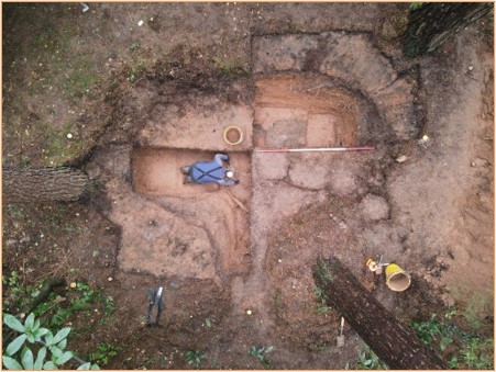
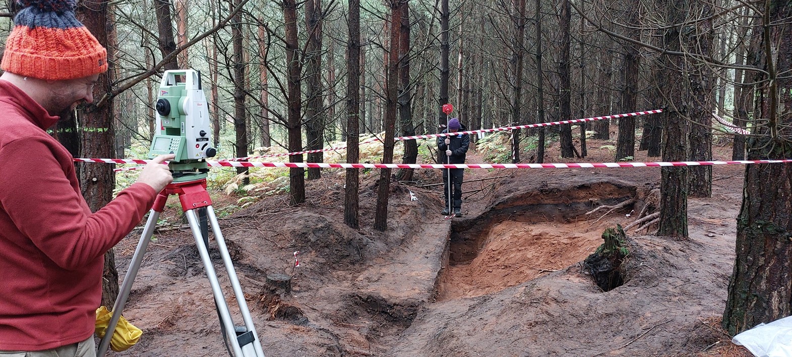
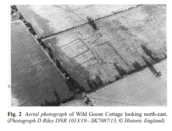
In the 1970s, crop marks were identified in an aerial photo in the area now known as Wild Goose Cottage, at Lound. The crop marks revealed evidence of two Iron Age Huts and three Romano British sub-rectangular enclosures.

Photograph of the excavated well at Wild Goose CottageAerial photograph of Wild Goose Cottage

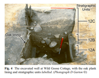
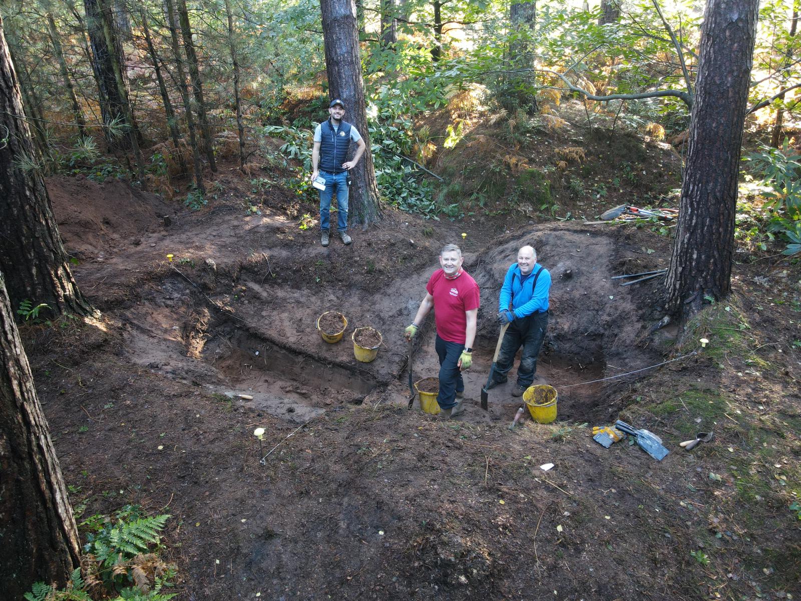
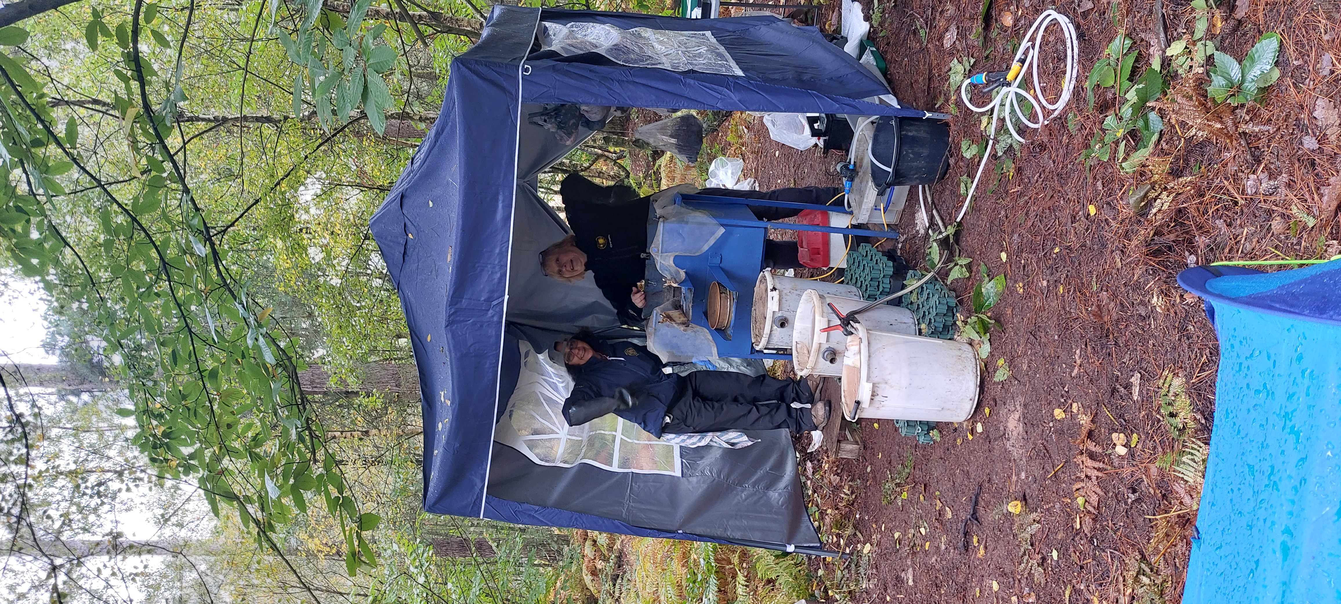
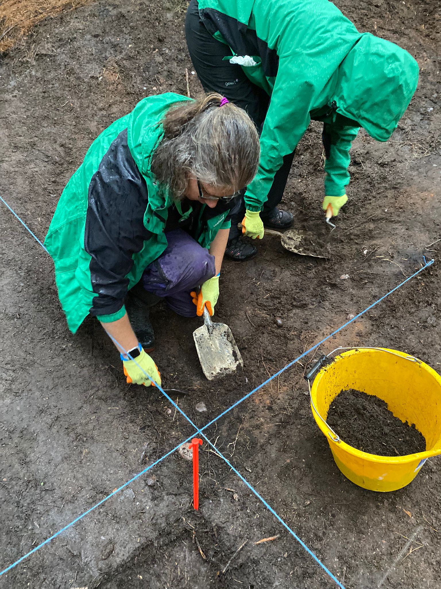
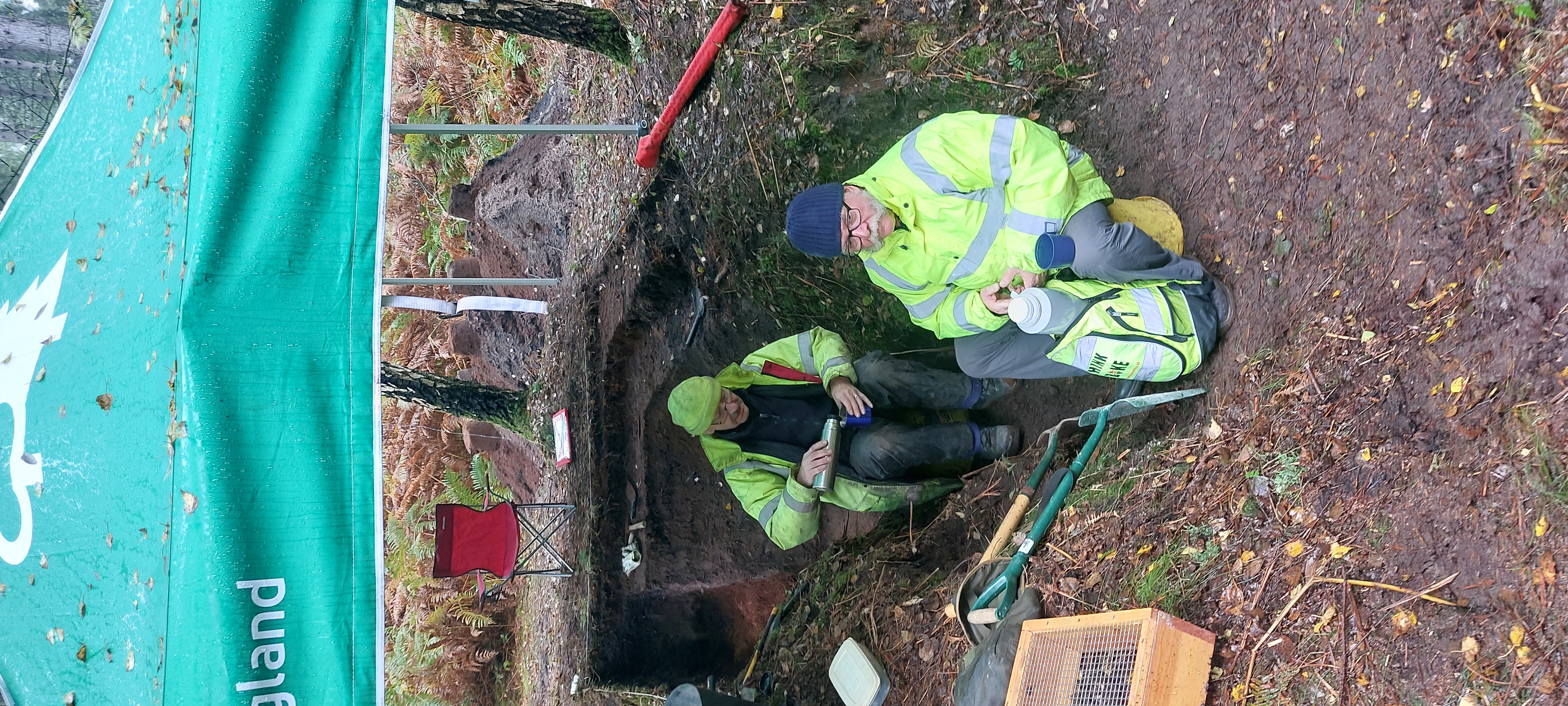
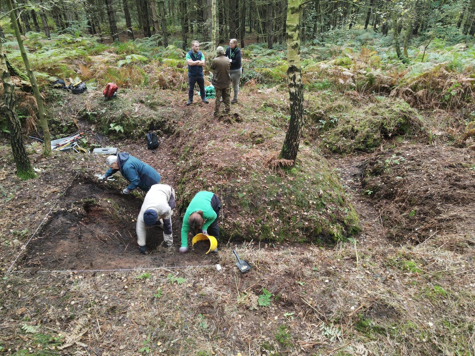
When the site was being cleared for mining in 1992, a well was discovered. The one-metre square well, lined with oak planks, was filled with household waste and soil (a common practice once wells are abandoned). Archaeologists collected soil samples from the well for paleoenvironmental analysis. The samples contained flora and fauna that lived in the well while it was operational, and soils from the surrounding area that were used to backfill it.

By sieving through these samples and extracting organic matter under the microscope, 163 species of seeds, pollen, and insects were identified. What did this evidence reveal? Firstly, the snail species present are known to prefer open habitats to dense forests. Secondly, pollens from cereals indicate open damp grasslands in the floodplain, while other species indicated drier, sandier pastures with hedged fields to the west. Finally, seeds associated with grazing animals and dung living insects suggest the keeping of livestock. This evidence enabled archaeologists to build a profile of an open, grazed landscape during the Roman times, more like today than the dense medieval forest.

The post-Roman development of Sherwood Forest is well documented. It was created as a royal hunting forest after the Norman Invasion of 1066. By the 1200’s it covered 100,000 acres. Medieval forests were carefully managed for their wood resources, but by the time of the Civil War, the forest was lacking proper management and in decline. Large areas were gifted to local aristocrats, forming the ‘Dukeries’. They profited from the sale of timber to the navy and for construction purposes. Deforestation continued with the Industrial Revolution and the two world wars. By the 1950s, the area was no longer economically viable. Forestry operations were abandoned, and wild woods began to flourish again. In 1954 Birklands was designated a site of Special Scientific Interest, leading to the creation of Sherwood Forest Country Park, a heritage site of international significance, popular for recreation and tourism.

Human activity has transformed Sherwood Forest over the centuries. Using paleoenvironmental data, archaeology, and historical records, we can develop an understanding of the evolving relationship between people and Sherwood Forest, through time.

Find out more using the links below:

Wild Goose Cottage Monument

Paleoenvironmental Sampling

The history of Sherwood Forest

Recommended additional reading:

'Caught in a trap: landscape and climate implications of the insect fauna from a Roman well in Sherwood Forest'. Archaeological and Anthropological Sciences 10:125–140. Paul C. Buckland & Philip I. Buckland & Eva Panagiotakopulu. 2018.

Miner2Major Logo BannerVisit the Miner2Major website here

Instagram | Twitter/X | Facebook

Nottinghamshire County Council and Forestry England have worked together to help shed more light on the archaeology buried within Sherwood Pines. A crew of volunteers assembled from Operation Nightingale and Forestry England have excavated three archaeological targets within the WWI training trenches within the forest. These features were selected over the course of several months, where specialists consulted the HER, conducted thorough archival research, and carefully studied the LiDAR survey data in the area (more information can be found here: The Veiled Landscape: Sherwood Lidar Project - Nottinghamshire Historic Environment Record) . Soil samples were collected on site and processed to help us understand the environment of the past, and a metal detector and unexploded ordnance officer were also on site to lead in the discovery of a number of fascinating finds (and help keep us safe while doing so!)

Photograph of Sherwood Pines Excavation

A huge thanks goes out to the volunteers who braved the very wet conditions to help us better understand this important relic landscape and improve the management of the WWI trench network within the Sherwood Pines.

Photograph of a group excavating Sherwood Pines

To find out more about the Clipstone Camp and the effects of WWI in Nottinghamshire:

Check out some more photographs from the excavation below:

Photograph of a couple of people on a break at Sherwood Pines Photograph of a man showing a find from Sherwood Pines 

Photograph of a couple of people excavating Sherwood Pines Photograph of a couple of people having a break from excavating Sherwood Pines 

Photograph of a group excavating Sherwood Pines

Delivered as part of the Miner2Major Landscape Partnership scheme, supported by the National Lottery Heritage Fund.

Miner2Major Logo Banner

Follow the project: Instagram | TwitterFacebook