Are Straight Roads Always Built By The Romans?
- Posted in:
- Heritage
- Archaeology
‘This road was built by the Romans, see how straight it is!’
A phrase said by many-a-parent to their kids on long road trips as an attempt delay the inevitable ‘are we nearly there yet’ question. If you are anything like me, you’d peer out of the car window in wonder, watching the hedgerows and signposts swoosh past, trying to imagine instead a scene filled with Roman soldiers in bright lorica segmentata armour and banners fluttering in the breeze.
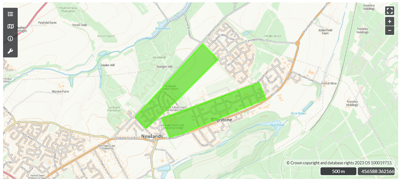
Some of these great highways built by the Romans became so embedded in our later infrastructure that they are major highways nearly 2000 years later. The A46 Fosse Way, which runs askew through Nottinghamshire from Gallows Nooking in the east to Broughton Lodge in the south, is one such road. Laid and re-laid, tweaked, and re-routed over the centuries to the point where in places the modern route has been altered entirely to avoid and protect Roman towns, like Margidunum.
When you see a long straight road on a map you may wonder ‘was that built by the Romans?', but how do we find out if that was the case? For some roads it is pretty straightforward. Many of our well-known Roman roads, like the Fosse Way and the road from Lindum (Lincoln) to Danum (Doncaster), are detailed in the Roman versions of road maps called ‘itineraries’. These aren’t maps in the same way we imagine them, but rather lists of places you will find along certain roads and the distance between them. This is how we can know the names of some of the deserted towns like Segelocum (Littleborough) and Crococalana (Brough).
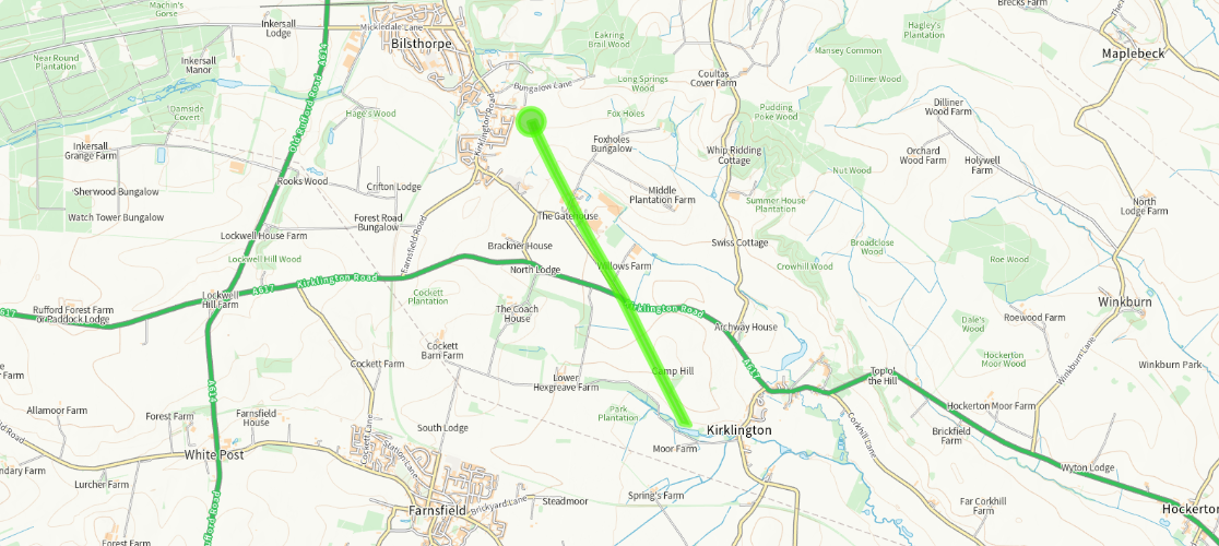
Above: Map of the Roman road stretching from Bilsthorpe to Kirklington.
But the Romans built more roads than we have itineraries for, so how can we spot the rest?
The problem with identifying Roman roads is that they were built a long time ago and nearly 2000 years has since intervened. Some routes went out of use as soon as the army didn’t need them in the early years after invasion, others when the Roman infrastructure broke down as Rome abandoned the province. Others remained in-use as long-distance highways that didn’t necessarily link places where people lived but were useful for getting around. The A46 in Nottinghamshire is a good example of this. In some cases a Roman town persisted, such as Lincoln, and the Roman roads became embedded in the later settlement structure.
People try to spot Roman roads by looking for straight ones, but they aren’t all ruler-straight, especially after 2000 years. The Romans were efficient with their road building, but not stupid, and would squiggle to avoid some things and to course-correct. If the road survived, with only sporadic local maintenance, it might wander across the landscape as it ebbed and flowed with use, much like the meandering of a river.
There are plenty of red-herrings too! Enclosure of common land, following the 1750 enclosure acts, led to the creation of new roads which were also straight and broad and often with many boundaries and roads at right-angles to them. So, there are subtle clues you have to look for to decide whether you’re likely looking at a Roman road or an enclosure one.
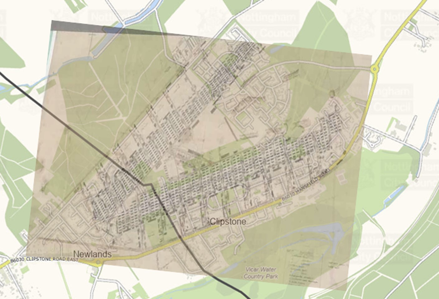
Without digging and finding the Roman road surface, we have to go on the ‘balance of evidence’. Does it link places of significance in Roman times? Does it appear to pre-date the other boundaries in the area? Even where we know that we are looking at a Roman road such as the A46, it was very rare that the recent dualling work uncovered anything that looked like the original road surface.
The reality is that some routes that we use today may be very old indeed, while others exist only as the ghosts of trackways appearing as cropmarks in fields. For most of them their origins will remain elusive until we have more evidence that we can piece together.