February 2026 Nottinghamshire Heritage Events
- Posted in:
- GetInvolved
There are some exciting heritage events happening in Nottinghamshire. Check out some of them below:
Monday 2nd Feb: ‘Join Professor Matthew Tocheri online to discover the fascinating story of 'the hobbits of human evolution': Homo floresiensis’. The talk, in association with Creswell Crags, will explore the past, present and future research and representations of this extinct group. This event is free (donations welcome) but booking is required. Book your place here.
Tuesday 3rd Feb: At Hucknall Library, ‘join local historian Denis Hill, for an insight into the fascinating history and heritage of the townships of Ashfield district. For this – the first of two talks – he will focus on Hucknall, Annesley and Selston, each of which has much to shout about and celebrate, but which may be generally unknown’. This event is free but booking is required. Book your place here.
Wednesday 4th Feb: As part of the celebration of LGBT+ month, ‘bestselling author Gareth Russell [is presenting] a special talk centred on his new book 'Queen James’. ‘This event explores LGBTQ+ narratives woven through royal history’ in association with the National Civil War Centre. Tickets for this event at the Palace Theatre, Newark, cost up to £10 per person and booking is required. Book your place here.
Tuesday 10th Feb: ‘In the second part of Denis Hill’s celebration of Ashfield’s heritage he will focus on Kirkby, Skegby, Sutton and Teversall. Throughout the district Denis identifies numerous historical ‘firsts’ or ‘oldest’ inventions connected to our industrial heritage of which local residents may be justly proud.’ This talk at Hucknall Library is also free but booking is required. Book your place here.
Wednesday 11th Feb: At Lakeside Arts, join Alan Micklethwaite, ‘a sculptor, stone carver and conservator, who has worked on the conservation of historic buildings for more than 30 years’ for talk on his insights into traditional and modern ‘techniques and processes involved’ in restoring and repairing ‘sculpture[s] on historic monuments and buildings’. Tickets for his talk ‘Restoration Stone Carving’ cost up to £3.50 per person and booking is required. Book your place here.
Friday 13th Feb: ‘In 1642, when Charles I raised his standard in Nottingham, he ruled not just England, Ireland, and Scotland, but also “the dominions thereunto belonging”. These distant settlement, most small and new, were drawn into events at home, and the English Atlantic was shaped by the civil wars, regicide, and experiments in new forms of government over the next two decades. Join distinguished Professor and Joyce Appleby Endowed Chair of the America in the World, Carla Pestana, for this insightful talk’: ‘The British Civil War and the Wider World’ at the Palace Theatre, Newark in association with the National Civil War Centre. Tickets cost up to £10 per person and booking is required. Book your place here.
Tuesday 17th Feb: Head to Mansfield Central Library ‘for a talk by Roger West, author of Red Blood for Black Gold to hear the story of how this local mining history was written’. Tickets cost £3 per person and booking is required. Book your place here.
Friday 20th Feb: ‘Get acquainted with the world famous ancient oaks of Sherwood Forest with our tree expert, Rob Pedley. Sherwood has one of the highest densities of ancient oaks in the world. These impressive trees provide vital habitat for an abundance of species and play a crucial role in supporting the health of the forest. The walk leader will introduce you to a handful of these giants, giving you an insight into the life of a veteran oak’. Tickets cost up to £13 per adult. Book your place here.
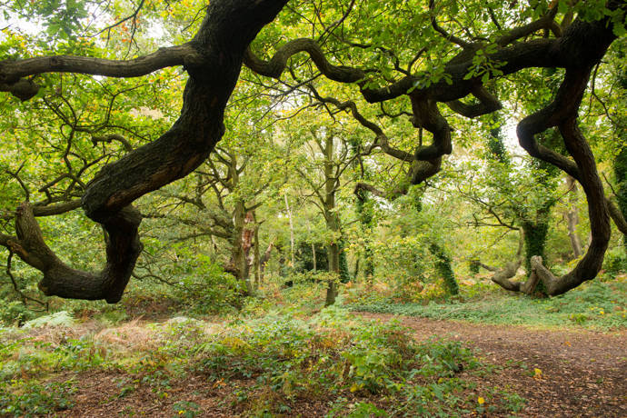
Above: Sherwood Forest